The previous circular defined the Sea of Azov and Black Sea listing together, using a series of coordinates from the Ukraine–Romania border to the Russia–Georgia border.
The new circular lists the Sea of Azov separately and extends the Black Sea listing to the whole sea except the territorial waters of Bulgaria, Georgia, Romania and Türkiye. Russian and Ukrainian territorial waters are included.
Benin, Djibouti, Eritrea, Libya, Nigeria, Somalia, Sudan and Togo.
Cabo Delgado. Specified parts of the territorial seas of Mozambique and Tanzania.
Gulf of Guinea. The area defined by the circular from the Togolese coast via a point offshore to Cape Lopez, Gabon.
Europe
Sea of Azov.
Black Sea. Includes international waters and the territorial waters of Russia and Ukraine. The territorial waters of Bulgaria, Georgia, Romania and Türkiye are excluded.
All Ukrainian inland waters, including those in Crimea and other Ukrainian territory under Russian control.
Russia’s River Don from the Sea of Azov to 41°E, and the River Donets from its junction with the Don to the Ukrainian border.
Inland waters of Belarus south of 52°30′N.
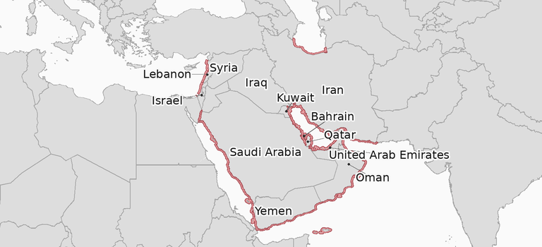
Persian Gulf, Gulf of Oman and adjoining waters
One area defined by coordinates covers waters in the Persian (Arabian) Gulf, Gulf of Oman, Indian Ocean, Gulf of Aden and southern Red Sea.
The Red Sea boundary is 25.5°N. Listed waters lie south of that line, with Egyptian territorial waters excluded.
Middle East
Bahrain, Iran, Israel, Kuwait, Lebanon, Oman, Qatar, Saudi Arabia, Syria, the United Arab Emirates and Yemen.
Iraq, with its offshore oil terminals also covered by the listing.
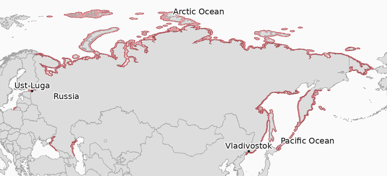
Russia
The country listing covers ports and coastal waters under the circular’s named-country definition. The specified Russian inland waters are listed under Europe.
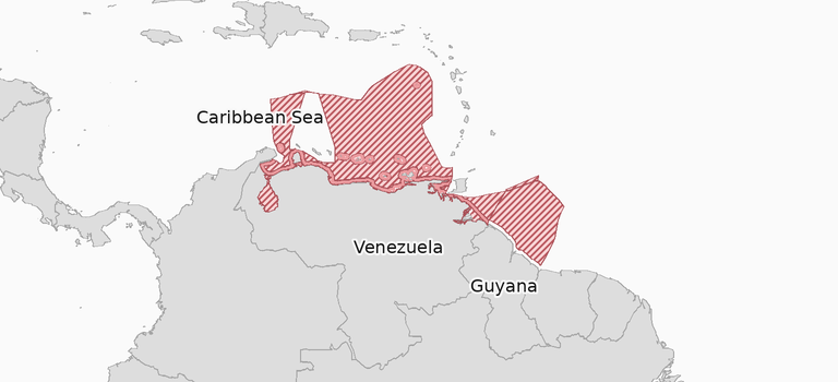
South America
Guyana. Limited to calls at offshore installations in Guyana’s exclusive economic zone beyond its territorial waters.
Venezuela. The listing extends to all offshore installations in Venezuela’s exclusive economic zone.
The circular generally includes ports and coastal waters up to 12 nautical miles offshore for named countries, subject to any specific limits. See JWLA-035 for the exact boundaries and coordinates.